Dehradun

 dehradun.

Nature at its Benevolent Best

BEYOND DEHRADUN

Mussoori
Mussoorie is known as the queen of hill stations. In 1820 Captain Young of the British army was influenced by the beauty of this place and made this place his residence. This marked the foundation of a hill station aptly called Mussoorie. The name, Mussoorie is derived from plants of ‘Mussoorie’ which were found in abundance here. When the plains of north India experience heat waves, Mussoorie provides a welcome break, overlooking picturesque Doon valley. From Dehradun one can hire a taxi or take a bus to Mussoorie.

Chandrabani
7 kms. from Dehradun on the Dehradun. Delhi route is the famous temple of Chandrabani (Gautam Kund). According to the myth, this spot was inhabited by Mahirishi Gautam, his wife and daughter Anjani who is widely worshiped by the people. It is believed that the daughter of Ganga had manifested herself on this spot which is now popularly known as the Gautam Kund. Every year devotees, in large numbers, take a dip in this holy kund, 2 kms. away from the main road. Located amidst the Shivalik hills, the place is a major tourist spot.

Dakpathar
45  kms. from Dehradun, Dakpathar is a beautiful tourist sport in the western Doon Valley, amidst the Shivalik range The place is connected by a regular bus service. Accommodation is available in a Tourist Rest House of GMVN with swimming pool facilities.

Rajaji National Parkrajaji national-2
Rajaji National Park is spread over an area of 820 sq. kms., the park with it’s magnificent ecosystem, is nestled in the lush valley of Shivalik ranges. It represents the flora of several zones of the forest, reverine, broad leaf mixed forest, chirpine forest, scrub land and grassy pasture lands. There are 23 species of mammals and 315 of avi-fauna here. Named after Late Shri C.Rajgoplalachari, popularly known as Rajaji. Best Tourist season is between November to mid June.

Tibetan Temple
Situated on Rajpur Road adjacent to the Sai Darbar is the Tibetan Temple a temple devoted to Lord Buddha with all it’s rich Tibetan traditions, culture and ambience.

Kalanga Monument
Located on the right  of the Dehradun. Sahastradhara route, the Kalanga monument recalls the story of the bravery of a 180 year old battle between the British and the Gorkhas. Perched on the hill, 1000 ft over the bank of river Rispana, the monument represents the history of the rulers of Garhwal.

Indian Military Academy
Indian Military Academy was established in 1932. It is Situated 8 kms. On Dehradun-Chakrata road and 3 kms. Beyond F.R.I., Dehradun. It is a premier training institute for the Indian Army Officers. The academy has places of tourist interest that includes the Museum, Library, war Memorial, Arms and ammunition, Shooting demonstration room, FRIMS Golf Course (18 holes) etc.

Wadia Institute of Himalyan Geology
The Wadia Institute of Himalyan Geology is an autonomous research Institute of the Department of science & Technology, Government of India. The Institue was shifted to Dehradun from Delhi in 1976. It is named after the late prof. D.N.Wadia (founder of uphill from the Clock Tower. The institute carries out research in Himalayan Geology and related fields.

Tapkeshwar Templetapkeshwar mandir
Tapkeshwar Shiv Temple is an ancient place of worship. The temple is situated on the banks of a rivulet in Garhi Cantt area. It is 5.5 kms. from the city bus stand and is well connected by road. It is named Tapkeshwar as water droplets, originating from a rock, fall on the Shivling placed in the shrine. People in large numbers participate in the fair organized on the occasion of Shivratri. The whole mela spot wear a glory look.

Robber’s Cave (Guchhupani)
An ideal place for picnic, Robber’s Cave is 8 kms. from the city in Garhi Cantt area. The last one kilometer is to be trekked to reach this beautiful cave formed by a natural rift in a mountain. Through this flows a very stream of water. The darkness of the cave combined with the sound of the fast flowing stream gushing past the feet gives it an unforgettable touch.

Tapovan
Situated near Raipur/Sahastradhara crossing Tapovan is famous for its beautiful surroundings and its auspicious nature relating to Hindu mythology. It is a common sight even today, to find hermits doing all sorts of penance to appease the Gods in Tapovan. Its location is approx 5 kms. from Dehradun. Lagend has it that Guru Dronacharya had done penance in the area.

The Educational Centre
Dehradhun is well known for its quality education standard and these high standards are due to the presence of century Old Catholic and Protestant convent schools. It is a home to over 300 high schools including the famous Doon School, which is considered to be the best public school in India. Some of the other peopular schools are:

Army School (located in Indian Military Academy

  • Brightlands School
  • Brooklyn School
  • Cambrian Hall
  • Colonel Brown Cambridge School
  • Convent of Jesus and Mary High School
  • Marshalls School
  • Raja Rammohan Roy Academy
  • (now known as Cambridge School)
  • Riverdale High School
  • St. Mary’s Convent School
  • Shri Guru Ram Rai Public School
  • St. Joseph’s Academy
  • welham boys’ School
  • Welham Girls’High School
  • The Army Public School
  • Neshville Day School
  • Asian School
  • Various Kendriya Vidhyalayas

Dehradun Basics
230 km. from Delhi, Dehradun is set amidst a valleyin the Shivaliks, The foothills of the Himalayas at an altitude of 2,200 feet above sea level. Dehradun has a population of 447,808. Males  constitute 53% of the population and females 47% Dehradun has an average literacy rate of 77%.The city has cold winters season, mild hot summer, rainy monsoon season and a balmy spring season. The winter ranges from November to February in which the months of  December and January are the coldest due to winter rains, coinciding with snow-fall in the nearby mountains ranges. While the spring from March to April are very pleasant,Summer lasts from April-May to July followed by good monsoon months till September. You can enjoy the magic of all seasons in Dehradun.

A CULTURAL TOWN
As the capital of the new State Uttarakhand   (earlier known as Uttaranchal) Dehradun is bustling, energetic and line city, with a fair share of young energy poured into it. The famous Clock-Tower (Ghanta-ghar) is the center of activities, and a popular landmark of the city from where one can venture in famous pattern. A tall structure with 6 clodks; many efforts in the last years to revive the clocks have unsuccessful. The numerous high schools of the city attract the brightest of the best students from all over the country. During the day it is common to see students (dressed in various high-school uniforms) to be moving around the city. It’s a major hub of cultural activities round the year. The city has witnessed tremendous growth blocks, shopping centres and cultural institutions after the formation of Uttarakhand State. It is always a favourite destination for the retired army personnel. For the younger people, the popular downtown destinations include Astley Hall, Rajpur Road, Capri Trade Centre, Connaught place et.al.

A HISTORICAL TOWN
Dehradun, is the capital city of the Uttarakhand State (earlier known as Uttaranchal) of India, and the headquarters of Dehradun District. Located in the Doon valley, 230 kilometers north of Delhi, it is surrounded by the Himalaya in the north, Shivalik Hills in the south, the river Ganga in the east, and the river Yamuna in the west. The water divide of Ganga and Yamuna passes through the city. It is also located on the northem side of the fertile Gangetic plains of India. Before the creation of Uttarakhand on November 9, 2000, Dehradun was a part of Uttar Pradesh. In Hindi, Dehra is termed a camp. According to popular belief, the military camp located here, most possibly during Anglo-Gurkha war oritginated the name Dehra Dun. Some believe that the “Dehra” is referred to Ram Rai (Son of Guru Har Raj, the seventh Guru of the Sikhs.) He founded a Gurudwara here in the olden times. The earliest tangible evidence of the history of Dehradun dates back to 300 BC, as indicated by a rock inscription at Kalsi, discovered in 1860.

This inscription located at the northem outskirts of the city are kattributed to King Ashoka. In the inscription, there are 14 edicts carved on a rock and adjacent to these is the site where Raja Shilvarman of the Vrisheri dynasty made three horse sacrifices during his rule in the 3rd century BC. It is also believed that in Vedic times, the Garhwal Mandal, of which Dehradun is a part, was known as the Kedar Khand. Legend has it that Guru Dronacharaya, the royal teacher of the Kauravas and Pandavas in Mahabharat set up his known as Dehradun. Therefore It is also referred to as Dronpuri in history. According to the Ramayana. Lord Rama and his brother Lakshmana under took apenance in Dehradun for killing Ravana, the demon king of Lanka.  The next prominent rulers of the valley were the Katyuris of Garhwal. Next, this stronghold of the Katyuri dynasty, passed into the hands of the Sikhs and Mughals subsequently and later, the Gorkhas of Nepal ruled here for a long time. In April 1815 Gorkhas were ousted from Garhwal region and Garhwal was annexed by the British during British rule, Dehradun used to be the summer base for the Viceroy’s bodyguards. The British also established the Forest Research Institute in 1906, the R.I.M.C (Royal Indian Military College, now Rashtriya Indian Military College in 1922) as well as the Indian Military Academy (in 1932). In due course of time Dehradun became a prominent centre for education and developed as a military cantonment and settlement.

WHAT TO SEE

Sahastradharasahastradhara-2
Sahastra Dhara, laterally means, the ‘thousand springs’ is at a distance of 11 kms from Dehra Dun. The place is a picturesque picnic spot. The Baldi River and the caves provide a breath-taking view. The water here has a fall of about 9 meters and leaves an incrustation of lime on all its touches. Particles thus accumulating over the centuries have  formed a projecting ledge, and a sort of cave, from the roof of which falls a perpetual shower, There is also a sulphur spring known for its medicinal value, in which visitors often take bath. It is believed that, the water can cure skin infections and possesses other medicinal properties.

Malsi Deer Park
10  kms. From Dehradun,enroute to Mussoorie is situated a beautifully developed tourist sport lying at the foothills of the Shivalik range. Malsi Deer Park is a mini-zoological park comprising children’s park enveloped by beautiful land, natural surroundings. This is also an ideal picnic spot for tourists.Lacchiwala

Lachhiwala
Lachhiwala is 22 kms. Off Dehradun while approaching from Haridwar-Rishikesh. An extension of the Rajaji National Park, It is a serene and blissful spot among tall Deodar forests with water springs running all year round.

Bhagirathi Resorts
18  kms. Away from the city along Chakrata Road, Bhagirathi resorts is situated in Selaqui village. From here one can experience a clear view of the majestic Himalyan ranges. The resort lures tourists with its swimming pool, water slides, fountains and other fun, floric & recreational activities.

Santala Devi Temple
The famous temple of Santala Devi is about 15 kms. away from Dehradun.  A 2 kms. Trek  takes you to this temple. The temple stands as a symbol of the faith and fervor among devotees people and it has a great cultural and religious singnificance. Santala Devi, alongwith her brother, on realizing that they would not be able to face the mighty Mughal  Army. Abandoned their weapons and started offering pray. A light flickered and within moments they both were transformed into stone images. It is within the fort that the shrine was built and Saturdays marks the transformation of the Goddess into stone.

Asan Barrage water sports Resortdhalipur lake
A famous water sports resort has been developed at the Asan Barrage by Garhwal Mandal Vikas Nigam in the year 1994. Asan Barrage was created in 1967 and it is popularly known as Dhalipur Lake. Situated 43 kms. From Dehradun on Chandigarh-Shimla highway, the resort offers facilities like water skiing, boating, rowing, kayaking, canoeing etc. During the winter season you can also see a fleet of migratory birds here.

The Zoological Survey of India
Fourded in 1916, the Zoological Survey of India, 5 kms. away on Kaulagarh road, a wing of the Ministry of Environment and Forests, is a premier National Institute exploring the faunal diversity of the country. It undertakes surveys in all the biogeographic zones to collect, identify, collate and inventories faunal diversity of our country. The museum of this institute has a variety of Himalayan faunal diversity.

Indian Institute of Petroleum (IIP)
Indian Institute of Petroleum is situated at Mohkampur, Dehradun. Its major activities involves developing processes and products for petroleum refining and petrochemical industries, to provide technical services, to carry out R&D work, training of personnels in oil and petrochemical industries, assisting in formulation of standards for petroleum products for the country.

Oil & Natural Gas Corporation Ltd. (ONGC)
Founded in 1956, ONGC is the premier exploration and production company in India and accounts for 90% of the exploration effort, established reserves and production of oil and gas in the country. ONGC is a powerful organization with financial, technical and infrastructural strength to match any large oil company in the world.

Rashtriya Indian Military College (RIMC)
The Rashtriya Indian Millitary College (RIMC) was established in 1922. The College is spread over an area of 138 acres in Dehradun Cantonment area. The College is administered by the Union Ministry of Defence Army Headquartered at New Delhi. The primary purpose envisaged for the college is to find out suitable candidates and train them for National Defence Academy.

Survey of India
It’s the National Survey and Mapping Organization of the country. The Oldest scientific department of the Government of India. It was set up in 1767. The Survey of India acts as adviser to the Government of India on all survey matters, viz Geodesy, Photogrammetry, and Mapping & Map Reproduction.

Indian Council of Forestry Research and Education (ICFRE)
The Indian Council of Forestry Research and Education (ICFRE) is an autonomous body under the Ministry of Environment and Forests, Government of India. The Council is the apex body in the national forestry research system to develop holistic forestry research through planning, promoting, conducting and coordinating research, education and extension on all aspects of forestry for ensuring  scientific management of forest, tree improvement, forestry productivity through scientific and biotechnological research, bioremediation of degraded land, efficient utilization of forest produce, forest based value addition, conservation of biodiversity, effective agro-forestry models for various agro-ecological zones, policy research, environmental impact assessment and integrated pest management and disease.

PLEASE OBSERVE THE DO’S AND DON’T’S DO’S

Limit deforestation, make no open fires and discourage others from doing so. Choose accommodation that uses kerosene or fuel efficient wood stoves. Use of fire wood should be minimized. Carry away all non-degradable litter and burn or bury paper before leaving any spot. Extinguish any burning cigarette butts and dispose off glass bottles properly, they should not be left lying in the open but should be covered or buried. Avoid using polythene, if you do, do not throw it away, but collect it separate. Take permission before taking photographs and respect privacy.  Observes the rules and regulations while visiting holy sites. Propagate and pursue conservation in cooperation with fellow tourist, guides and porters.

DONTS

Avoid using pollutants such as detergents, in streams or springs. Abstain from graffiti and contribute in keeping environment clean. Allow the flora to flourish in its natural environment. Taking away plant, cuttings seeds and roots is illegal in many parts of the Himalayas. Nestled in the gorgeous mountain ranges of the Himalayas, Dehradun is one of the oldest and fast emerging modern city of India. Also known as the “abode of Guru Dron”, Dehradun has always been an important center of Garhwal rulers which was subsequently conquered by the British. The headquarters of many National Institutes of repute like ONGC, Survey of India, Dehradun also has a string of premier educational institutes like the Forest Research Institute (FRI), Rashtriya Indian Military College (RIMC), and the Indian Military Academy (IMA) besides a host of prestigious public schools. For years, Dehradun has been one of  the best known educational centres in the whole Northern India. With Illustrious history, Royal, salubrious nature, hospitable people, cultural abundance it is the entry point to some beautiful hill stations, pilgrimage sites and to the upper Himalayas. The city is most favoured tourist destination of India.

WHERE TO STAY
Government

  • PWD inspection House (Rajpur Road)
  • Circuit House (New Cantt. Road, Reservation-DM)
  • Railway  Rest Houses (Railway Station, Reservation-Station Supdt.)
  • FRI Inspection House (FRI, Reservation Incharge Rest House)
  • Survey of India (Hathi Barkala, Reservation-Asst. Surveyor)
  • ONGC Guest House (Tail Bhawan, Reservation-GM Admn)
  • YMCA (Rajpur Road, Reservation-President YMCA)
  • MES Guest House (Cantt, Reservation-Garrison Engineer)


Chaukori

chaukori

A Himalayan Hideaway

Chaukori a dream, surrounded by the towering Himalayan peaks and dense forests. At a height of 2,010 mtrs, above the sea level and 173 km away from Nainital, Chaukori is not just another hill station, but it’s for the very few, who want to be there, in the majestic proximity of the Himalayas for an unbound view of tpanchkuli peakshe Nanda Devi and Panchchauli peaks. Chaykori is one of the few places in Kumaon, where you will find tea gardens. As the name suggests, it’s like a bowl, cupped within the Himalayan heartland. It is an idyllic holiday resort amidst unspoilt nature, a land bestowed with natural abundance, fruit orchards, and the jungles of pines, oaks and Rhododendrons. One of the most magnificent aspects of holidaying in Chaukori is the fabulous sunrise and sunset that you treated to. The night sky is studded with a million stars that simply take your breath away. The charming little town of Chaukori is unlike any other hill station you have seen. Chaukori is a somnolent, peaceful hamlet in pithoragarh district of the Kumaon Hills of Uttarakhand.

What to see

Chaukori is the vantage point to the Himalayas. Due to its small population (just 300), high altitude and the magnificent location, it’s one of the most ideal spot for the travellers who seek an ideal hideway, far from the maddening city life. One can look at the awe-inspiring distant peaks, walk in to the forests and orchards and relax.

Beyond Chaukori

Patal Bhuvaneshwar: It is situated 38 kms from Chaukori, at a height of 1,350 mtrs, on the road to Gangolihat. The temple here is within a cave. It’s believed to be the abode of 33 crore Gods.

Berinag: It is at the distance of 10 kms from Chaukori. Tea gardens here yield high quality tea. This place also offers a panoramic view of the Himalayas.

Gangolihat: 14 kms from Patal Bhubaneshwar. Gangolihat is rich in folk culture, music and religious traditions, and had been chosen by Shankaracharya for the installation of Mahakali Shaktipeeth.

Hotels

Girja Hotel, Gangolihat

Shah Hotel, Gangolihat.

W.D.Inspection House

Forest Rest House

How to Reach

Air: The nearest airport is Naini Saini at Pithoragarh (91 kms). No regular flights are available at present.

Rail: The nearest Railhead is Kathgodam, 198 kms.

Road: Chaukori is connected through metalled hill roads with all the major towns in the area. It is 480 km from Delhi and 173 km from Nainital. The most convenient way to get here is to drive from Delhi, via Haldwani – Almora.

Where to stay

  • KMVN Tourist Rest House
  • Him Darshan Hotel
  • Hills View
  • Hotel Panch Chuli
  • Angan Resort
  • Jhaltola Estate
  • Uttarayan Rest House      

There are many private hotels at Berinag barely 10 kms from Chaukori.

Char Dham

char-dham-big

A Journey into the Inner World!

The char Dham (‘the four abodes) is a term coined for four most revered Hindu pilgrimage destinations of Gangotri, Yamunotri, Kedarnath and Badrinath in the Garhwal region of Uttarakhand, in the Himalayas. While each site in the circuit has a unique history and singnificance that predates and remains distinct from their status as a circuit. The particular word Char Dham has, over the times, ingrained in popular imagination and pilgrimage practice. According to the Puranas and various Hindu scriptures, the Char Dham yatra is of the highest religious singnificance in a religious believer’s life. Pilgrims from all around the world brave the severe conditions of landscape and weather to visit the shrines for holy darshans of the revered deities.

The Evolution of a Pilgrimage

The beginning of the idea of ‘Char Dham’ is mirrored into obscurity and the word Char Dham four important pilgrimage centres Puri, Rameshwaram, Dwarka, and Badrinath were grouped together by the great 8th century reformer and philosopher Shankaracharya (Adi Sankara), into the archetypal all-India pilgrimage circuit to the cardinal points of the subcontinent. The three major sectarian movements in modern devotional Hinduism have representation, with the Vaishnava site (Badrinath) joined by one Shaiva site (Kedamth) and two Shakti sites (Yamunotri and Gangotri). Today, the Char Dham receives upwards of 250,000 visitors during an average pilgrimage season, which lasts from approximately April 15 until Diwali (sometime in November). The rush is heaviest in the two-month period before the monsoon.

The Circuit

Holy confluences, scenic surroundings and the aura of spiritual serenity make Char Dham an ideal religious destination. Traditionally, the yatra is done from the west to the east- starting from Yamunotri, then proceeding to Gangotri and finally to Kedarnath and Badrinath. Most pilgrims to the Char Dham enter the circuit at the famous town of Haridwar. Others disembark at Rishikesh, or from Dehradun, the capital of Uttarakhand. From there, the route is followed in this order:yamunotri

Yamunotri:
The source of the Yamuna River is a full day’s journey from Rishikesh, Haridwar or Dehradun. The temple of Goddess Yamuna is accessible by a 5 km walk from the town of Janki Chatti. Ritual duties are performed by the Uniyal family of priests. Unique aspects of ritual practice at the site include the hot springs where raw rice is cooked and made into Prasad.Gangotri Temple

Gangotri:
The holy source of the river Ganga and seat of the Goddess Ganga, can be reached in one day’s travel from Rishikesh or Haridwar and in two days from Yamunotri. Gangotri is also accessible directly be car and bus.   Ritual duties are supervised by the semwal family of pujaris. The aarti ceremony at the Gangotri is especially impressive, as is the temple, on the bank of the Ganga. The adventurous can make 17 km. trek to Gaumukh, the actual current source of the Ganga.

Kedarnath:kedarnath temple
Here the very form of God Shiva is venerated as one of the twelve Jyotirlingas. It is a two-day’s journey from Gangotri or from the journey points on the plains. Besides its affiliation with Shiva, Kedarnath is also believed to be the site of Shankaracharya’s smadhi. The most remote of the four Char Dhams, Kedarnath is known for its breathtaking view of the snow covered Himalayan peaks.

Badrinath:badrinath temple-2
The seat of the lord Vishnu in his aspect of Badrinarayan, is generally a two-day’s journey from either Kedarnath or one of the destination points on the plains. Perceived as the most important of the four Char Dhams, Badrinath gets more visitors than the other three sites, since the route to Badrinath is for much of the way to Hemkund Sahib also, the holy Sikh pilgrimage site.

Yamunotri
The first stopover for the Char Dham Yatra is the westernmost shrine of Yamunotri in the Garhwal Himalayas. Dedicated to Goddess Yamuna. Perched atop a flank of the Bandar Poonch peak (3165 mts. above sea level) and is situated opposite to Gangotri, the shrine attracts devotees in large numbers from May to October. Yamunotri is the source of the revered river Yamuna which originates from the Champassar Glacier, lying 1 km ahead of the shrine, at an altitude of 4421 mts. as it is not easily accessible. The source of Yamuna lies about 1 km. ahead at the altitude of about 4421 metres.  The approach is extremely difficult. Pilgrims do not frequently visit the source of the river and offer pooja at the temple itself.

The motorable road to Yamunotri continues till Jankichatti via Syanachatti, Ranachatti and Hanumanchatti, 50 km. from Barkot. From Jankichatti it is a 5 km. trek to Yamunotri for which ponies, dandies and kandies are also available. Yamunotri finds a special mention in the Hindu mythology. According to a legend, this secluded hilly spot was the home of an ancient sage, Asit Muni. Yamuna is the twin sister of Yama, the Lord of Death. It is believed that anyone who bathes in her waters will be spared a torturous death. Yamuna is also the daughter of Surya the Sun. Near the temple there are three hot springs. The most important, Surya Kund, is a tank full of boiling water into which rice and potatoes are dipped to be cooked and taken as “Prasad”. Near the Kund, a rock slab, the “Divya Shila” is worshipped before puja is offered to the black marble idol of Yamuna. A bath in the springs is very refreshing after a tedious 13 kms. trek from Hanumanchatti or 5 km. from Janki Chatti. The trek to Yamunotri is spectacular, dominated by a panorama of rugged peaks and forests.

What to See

Yamunotri Temple: The main temple is dedicated to Goddess Yamuna. The present temple was built by Maharani Guleria of jaipur in the late nineteenth century. Once destroyed by hot springs and cooking rice in its water are common rituals performed by the devotees. The temple remains closed from November tsurya-kundo May.

Surya Kund: There are a number of thermal springs in the vicinity of the temple which flow into numerous pools. The temperature of the water is very high 190 F. The most important of these is Surya Kund.

Divya Shila: A rock pillar, worshipped before entering the Yamunotri Temple. Origin of the Shila is not known. But this holds a place of reverence in the rituals in and around Yamunotri, since time immemorial.

Beyond Yamunotri

Sayanachatti: A majestically located scenic spot on the banks of river Yamuna. The surroundings offer great relief to the tourists trekking to the shrine.tJankiChatti

Jankichatti: Noted for its thermal springs, where tourists can enjoy a refreshing bath. Most of them wait here after a bath to freshen up the remaining journey.

Hanumanchatti: The confluence of Hanuman Ganga and Yamuna rivers, from where the trek to Dodi Tal (3,307 mts) starts.

Dodital: Literally meaning the Dodi Lake, is at an elevation of 3024 m north of Uttarkashi. Crystal clear waters are surrounded by dense oak woods, pine, deodar and rhododendrone. The lake is full of fish and is known for some rare species like the Himalayan Golden Trout. The trek from Dodital to Hanumanchatti via Darwa Top takes two days, moves on to the upper reaches of the Garhwal Himalayas in Yamunotri, the place where the sacred river Yamuna originates from

SUPPLEMENTARY ACCOMMODATION  

P.W.D. Inspection Bungalow at Barkot, Hanumanchatti

Forest Rest Houses at Dharasu, Janakichatti, Barkot, HanumanChatti

Ashrams & Dharamshalas At Yamunotri: kali Kamli Dharamshala, Mandir Samiti Dharamshala

Hotels:

AT Barkot: Shiva, Raturi, Rawat, Chauhan, Mishrwan, Agarwal Lodge, Rain Basera.

At Sayanachatti: Kalindi, Dipin Tourist Lodge, Jai Himalayan

At Ranachatti: Krishna Lok, chauhan, Ganga Yamuna, Sandeep

At JanakiChatti: Himalaya Darshan, Ganga Yamuna, Kalindi Mangal, Arvind Ashram

Dodital Yamunotri Trek

Haridwar-Kalyani: Drive to the road – head at Kalayani. The drive takes you through the picturesque Garhwal Mountains along the Ganges. Camp overnight by the side of river Asi Ganga. Overnight in Tents.

Kalyani-Dodital: A gradual uphill trek through beautiful landscape of thick forests and steep cliffs brings you to the mysterious Dodital Lake (3307 m) – surrounded by dense forests, which is an ideal place for the  nature lover. Overnight in Forest Rest House / Tents. Dodital – Day at leisure.

Dodital–Seema-Trek:  To Seema (16 km) with packed lunch. Overnight  in tents.

Seema-Hanumanchatti: Trek to Hanumanchatti (18 kms. / 2400 m.) with packed lunch. Over night at Hanumanchatti.

Hanumanchatti-Yamunotri: Trek to Yamunotri (14 kms. / 3165 m.) with packed lunch. Overnight at Yamunotri.

Gangotri  is the source of the river Ganges. Its an ideal location for the tourists looking for peace and adventure. It is important pilgrim site located at 3,048 m. above sea level. Gangotri is very close to the Indo-Tibetan border. Gangotri glacier, the original source of the sacred river Ganges is the 2nd longest glacier of Indian Himalaya after Siachin. It attracts tourists in large numbers every season. Along with the thrill of exploring nature, what one experiences here is the cpiritual aura that is completely Indian.

How to Reach

Air: Nearest airport is Jolly Grant, 18 kms from Rishikesh.

Rail: Nearest railhead is Rishikesh, 250 kms.

Road: The road to Yamunotri diverts at Dharasu, on way to Uttarkashi. Important road distances are: Hanumanchatti 14 kms., Dharasu 170 kms. Tehri 149  kms.

Bus: Hanumanchatti, the roadhead for Yamunotri is connected by bus services of Sanyukt Rotation Yatayat Vyavastha Samiti to Rishikesh, Haridwar and other major centres in the region.

Important Road Distances: Rishikesh to Yamunotri 222 kms. via Narendranagar 16 kms., Chamba 46 kms., Tehri 21 kms., Dharasu 42 kms., Bhramkhal 15 kms., Barkot 40 kms., Phoolchatti 5 kms., Jankichatti 3 kms., Yamunotri 6 kms. (14  kms. on foot from Hanumanchatti).

Where to stay

Dharamshalas and other alternative accommodations are available at Yamunotri. There is a Tourist Rest House (GMVN) at Janki Chatti.

Where to Eat

Only local small restaurants (Dhabas) are available. Non-vegetarian

 food and alcoholic drinks are prohibited in Yamunotri.

Stay on the Way:-

Tourist Rest Houses:-

Barkot: Type of room: Deluxe, Dormitor

Sayanachatti: Type of room: Ordinary

Hanumanchatti: Type of room: Executive, Dormitory

Janakischatti: Type of room: Executive, Ordinary, Dormitory

Yamunotri: Type of room: Dormitory

Gangotri

At Gangotri there is a temple dedifcated to Goddess Ganga and the sacred stone where Raja Bhagirath is believed to have worshipped Lord Shiva. The origin of the river is at Gaumukh, which is further 18 km trek along the Gangotri glacier. The holy river is called Bhagirathi at the source and acquires the name Ganga from Devprayag onwards where it meets Alaknanda. Gangotri can be reached in just one day’s travel from Rishikesh, Haridwar or Dehradun, or in two days from Yamunotri, the first site in the Char Dham circuit. Gangotri is easily accessible by car and bus, as a result that it sees more number of pilgrims than Yamunotri. This small town of Gangotri is centered around the temple of the goddess Ganga. Every year, lakhs of pilgrims throng the sacred temple between May and October. Ritual duties in the temple are supervised by the Semwal family of priests.

Adventurous pilgrims can make an overnight stay here. Before 17 kms. trek to Gaumukh, the actual source of the river Ganga. The verdant valleys, dense forests and towering peaks offer excellent trekking and mountaineering opportunities for adventure enthusiasts. For a large number of travelers, Gangotri town serves as the starting point of the Gangotri-Gaumukh-Tapovan and Gangotri-Kedartal trekking routes. Diwali day every year and is reopened in April or May. During this time, the idol of the goddess is kept at Mukhba village, near Harsil her winter abode (12 kms. downstream, home to the main Pandas of Gangotri). The other places of pilgrimage are Surya Kund, Vishnu Kund and Brahma  Kund located in the vicinity of Gangotri.

GaumukhGaumukh

Gaumukh is where the waters of Ganga trickle down from the glaciers. The sages called it ‘Gaumukh’, because in the distant past, it probably appeared like a cow’s mouth, though today it no longer appears so. The Gaumukh glacier is the source of Bhagirathi (Ganga) and is held in high esteem by the devouts who do not miss the opportunity to have the holy dip even in the bone chilling icy water. It is 18 kms. from Gangotri. There is a Tourist Bungalow at Bhojbasa, 14 kms. from Gangotri where lodging and other facilities are available. From Gangotri pilgrims move along the beaten track towards Chirbasa. From here, one can get a clear view of the Bhagirathi Peak.

Bhaironghati
At 2743 mt. further downstream, 10 kms. from Gangotri, is the picturesque forested halting place of Bhaironghati. There exists a small temple of Bhairon, appointed by Shiva to safeguard this region which gives the place its name. The bridge over the Jhanvi river at Bhaironghati is said to be the highest in Asia.

Beyond Gangotri

Nandanvan Tapovan
An arduous trek along the Gangotri Glacier leads to scenic Nandanvan – the base camp for the Bhagirathi peaks, that offers a panoramic view of the surrounding Shivling peak. A trek across  the snout of the Gangotri Glacier leads to Tapovan known for its beautiful meadows that encircle the base of the Shivling Peak.

Dharalidharali-
16 km downstream of Gangotri lies the township of Dharali, where also, it is believed that King Bhagirath had undergone penance. There one may see the submerged remains of a temple, termed Kedar Kund.

Gangnani
Hot springs are encountered at Gangnani, 56 km from Gangotri on the road to Uttarkashi, near the tank called Rishi-Kund is a temple dedicated to the Parasher, believed to be the father of Ved Vyas, author of the Mahabharat.

Kedar Tal
An enhancing lake, 4425 mts. above sea leval against the splendid backdrop of mighty Thalaiyasagar peak at a distance of 18 kms.. Accessible through a rough mountain trail, it is the base camp for trekking to surrounding peaks. The trek to Kedartal needs a local guide.
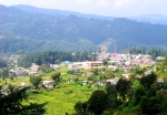
Uttarkashi
At a distance of 99 kms., its  a important pilgrimage centre, situated at an elevation of 1,150 mts. above sea level on the bank of river Bhagirathi. Some of the important temples worth visiting are – Vishwanath temple, Ekadash Rudra temple, Gyaneshwar temple and Kuteti Devi temple. Nearby is the Nehru Institute of Mountaineering. Every year, during the ‘Magh Mela’ people visit Uttarkashi to take a holy dip in Bhagirathi along with the image of their village deity.

Dayara Bugyaldayara bugyal
A breathtakingly beautiful meadow, situated at a height of 3,048 mts. above sea level at 93 kms. A motorable road connects Bhatwari (27 kms. from Uttarkashi) with Raithal village, from where follows a 6 kms. long trek to Dayara. The famous Sheshnag Temple enroute is an attraction of the trek. From Dayara, one can also trek down to Dodi Tal (30 kms.). During winters, Dayara provides excellent ski slopes over an area of 28 sq.kms.

Nachiketa Tal
A pleasant trek of 131 kms. through lush green forests leads to this peaceful retreat. A small temple along the lake and lovely surroundings are a major attraction.

GANGOTRI\BHOJBASA TREK: 5-6 HRS. Trek to Bhojbasa. The entire trek is along the roaring Bhagirathi River. Arrive at Bhojbasa and camp. Afternoon free to explore the area and to enjoy excellent sunset on Bhagirathi group of peaks. BHOJBASA/GAUMUKH Morning, enjoy the panoramic view of Bhagirathi group of peaks. Trek to Gaumukh, the source of the Ganges. Explore the area and trek to Bojbasa.

BHOJBASA/GANGOTRI TREK: 4-5 HRS. Morning trek, down to Gangotri.

How to Reach

Airport: Nearest airport is Jolly Grant, 17 kms. from Rishikesh and. 24 kms. from Dehradun, 275 kms. from Gangotri.

Railhead: Nearest railheads are Rishikesh (248 kms.), Haridwar and Dehradun.

Imp. Road Distances from Gangotri: Rishikesh (248 Kms.), Tehri (172 Km.), Dharasu (129 Km.), Yamunotri (224 Km.), Mussoorie (247 Km.)

Ashrams and Dharamshalas:

At Uttarkashi: Gangotri Mandir Dharamshala, Birla Dharamshala, Kali Kamli Dharamshala, Kailash Dharamshala, Shivanand Dharamshala, Dandi Kshetra Ashram, Bajoria Ashram, Mata Satyavati Ashram, Shanka Math Ashram,

At Gangotri: Sri Ganga Purohit Ashram, Gangotri Mandir Dharamshala, Kali Kamli Dharmashala, Punjab & Sind Dharamshala, Dandi Ashram, Eeshavasyam Ashram, Mauni Ashram, Birla Mangal Niketan, Ganga Niketan, Shanti Niketan, Bhagirathi Sadan, Acharya Sadan, Himalaya Sadan, Dalmia Sadan, Krishna Ashram, Bajoria Sadan, Jahnavi Ashram, Tarpadia Sadan, Ram Govind Bhawan, Bagad Dharmshala.

Where to Stay

Tourist Rest Houses

chinyalisaur:- Type of room: Executive

Uttarkashi:- Type of room: Deluxe, Executive, Ordinary, Family suite, Dormitory

Harsil:- Type of room: Deluxe, Executive, Dormitory

Lanka:- Type of room: Executive, Dormitory

Bhaironghati:- Type of room: Executive, ordinary

Gangotri:- Type of room: Deluxe, Ordinary, Dormitory

P.W.D Inspection Bungalows at Gangotri, Bhaironghati, Bhatwari, Harsil, Chinyalisaur. P.W.D. Rest Houses at Gangotri, Bhaironghati, Harsil, Dharasu and Uttarkashi (Kotbungla)

Kedarnath
Amidst the dramatic mountainscapes of the majestic range stands one of the twelve “Jyotirlingas” of Kedar or Lord Shiva. At an altitude of 3584 mts. and on the head of river Mandakani, the shrine of Kedarnath is amongst the holiest pilgrimages for the Hindus. There are more than 200  shrines dedicated to Lord Shiva in this district itself, the most important one being Kedarnath. Situated in the Rudraprayag district of Uttarankhand, Kedarnath is very close to the Indo-Chinese border. It is the source of the Mandakini River. Couched in the scenic locales of the Garhwal, the area is extremely cold in the winters with the ground being covered with snow. In the summers, the mercury barely crosses the 20 C mark. The best time to visit is between May and October. As per the tradition decided by Lord Brahma the temple would be open for six months i.e from Hindu calendar month Vaishaka to Kartik for darshan to the common people. For the remaining six months i.e from Margashirsh to Chaitra the temple would be closed for darshan to common people as it is now the Devas turn for Lord’s darshan. During the winters, the shrine is submerged in snow and hence is closed.

The Legend
According to a popular legend, the Mahabharata heroes, the Pandavas after having won over the Kauravas in the great Mahabharata war, felt guilty of having killed their own brothers and sought the blessings of Lord Shiva for redemption. He eluded them repeatedly and while fleeing took refuge at Kedarnath in the form of a bull. Bhima, one of the Pandava brothers, found Shiva amongst a herd of cattle. Having identified the grabbed him by the hindquarters. What remains at the shrine in Kedarnath is the rear end of the bull, with the rest of its body scattered throughout the Garhwal. Shiva dived into the ground leaving behind him a hump on the surface. This conical protrusion is worshipped as the idol. It is the main site of the Panch Kedar temples. The remaining portions of Lord Shiva appeared at four other places and are worshipped there as his manifestations. The arms appeared at Tungnath, the face at Rudranath, the belly at Madmaheshwar and his locks (hair) with head at Kalpeshwar. kedarnath and the four above mentioned shrines are treated as panch Kedar.

What to See

Kedarnath  is a majestic singht, standing in the middle of a wide plateau surrounded by lofty snow covered peaks. The Kedarnath Temple is situated at an altitude of 3580 m. amidst the background of snow covered mountain peaks and greenery. The temple is built of large, heavy and evenly cut grey slabs of stones and is considered more than 1000 years old. The temple has a garbha griha where a conical rock formation is situated and a Mandapam for seating of pilgrims and visitors. A large statue of the Nandi Bull is situated outside the temple door. The nearest motorable road is Gaurkund. The pilgrims have to trek 14 kms. to reach the temple. Dedicated to Lord Shiva, the exquisitely architecture Kedarnath temple is built of extremely large, heavy and evenly cut gray slabs of stones, it evokes wonder as to how these heavy slabs were handled in those ancient days! The present temple, built in the 8th century by Adi Shankaracharya, stands adjacent to the site of an earlier temple built by the Pandavas. The inner walls of the assembly hall are decorated with figures of various deities and scenes from mythology. Outside the temple door a large statue of the Nandi Bull stands as guard. The temple has a “Garbha Griha” for worship and a Mandap apt for assemblies of pilgrims and visitors. A conical rock formation inside the temple is worshipped as Lord Shiva in his Sadashiva form. Shankaracharya Samadhi: Behind the Kedarnath Temple lies the samadhi  or the final resting place of Adi Guru Shankaracharya. It is believed, after establishing the four dhams in India, he took his Samadhi at an early age of 32 years. It is surprising to believe, how at a tender age of 32, this enlighted man form the southernmost part of India, Kerala, travelled all across India, discussing religion, writing religious treatises, and at last resting eternally at the nothem most part of India, in the icy ground of Kedarnath!

Beyond Kedarnath

Chorabari (Gandhi Sarovar) a small lake from where Yudhishthir, the eldest of the Pandavas, is believed to have departed to heaven. The floating ice on the sparkling waters of the lake is a fascinating singht. Only 2 kms. trek away from Kedarnath. Floating-ice on the crystal clear waters of the lake fascinates the visitors.

Vasuki Talvasuki-tal-kedarnath
At a distance of 6  kms. from Kedarnath, a picturesque lake, 4,135 mts. above sea level is encircled by lofty mountains and offers a breathtaking view of the Chaukhamba peaks.

Son Prayag
At an elevation of 1829 mts. and on the main Kedarnath route at a distance of 20 kms., Son Prayag lies at the confluence of river Vasuki and Mandakani. The holy site of Son Prayag is of immense religious singnificance. It is said that a mere touch of the holy water of Son Prayag helps one to attain the “Baikunth Dham”,

Trijuginarayan
25 kms. from Kedarnath, a 5 kms, trek from Sonprayag, it is the mythological venue. According to legend, this was the place where the wedding of Lord Shiva and Parvati was solemnised. In front of the Shiva Temple is an eternal flame, which is said to be a witness to the marriage. It can also be reached by a 12 km. drive from Sonprayag.

Ukhimath
60 kms. From Kedarnath, its a major religious centre. Winter home  of the deity of the Kedarnath Temple and the seat of the Rawal of Kedarnath. Connected by bus services to Rudraprayag and other major centres.

Augustmuni
At a distance of 73kms. Famous for the temple dedicated to sage Agastya. From here Helicopter service is available for Kedarnath.

Guptkashi
49 kms. Off Kedarnath. The temples of Ardhnarishwar and Vishwanath are major attractions here. Guptkashi is the shrine at a height of 1319 mtrs. where Shiva went incognito.

Chandraswhila
93 kms. from the temple town. The Chandrashila peak provides a rare view of snow-clad peaks. The rhododendron Forests and alpine meadows dominate the trek from Tungnath to Chandrashila.

Deoria Taldeoria tal
68 kms. from Kedarnath. Sari village is the last the bus terminus on Chopta-Ukhimath road from where a 2 kms. trek leads to Deoria Tal. This beautiful lake at an altitude of 2,438 mts. gives the spectacular reflection of snow capped peaks in the lake water. Ideal spot for angling bird watching.

Four Other Kedars

  • Madmaheshwar
  • Tunganath
  • Kalpeshwar
  • Rudranath

Three of these (barring Kalpeshwar) are in mountain meadows at higher altitudes than Kedarnath. The climb to Rudranath is the most strenuous but lookwise this meadow is one of the finest in Garhwal.

Tungnath
The sanctity of the region of Tungnath is considered unsurpassed. The peak of Tungnath is the source of three springs that form the river Akashkamini.  At this temple at 3, 680 mts., Shiva’s arm is worshipped. The  highest Hindu shrine in the Himalayas, 3 kms. uphill from Chopta, Tungnath is reached throught a path  that wends through alpine meadows and rhododendron thickets. An hour’s climb from here leads to Chandrashila with its panoramic views. The entire journey and the shrine are located in some of the finest, most picturesque realm of the Himalayas.

Rudranath
Situated amidst thick woods, here the ‘mukh’ or the Lord’s face appeared and Shiva is worshipped as Neelkanth Mahadev. Situated at a height of 2,286 m. all around are fragrant flower laden meadows where herbs, grow in profusion. In the background, in all their glory, are the glittering snow- covered peaks of Trishul, Nanda Devi, Devasthan etc. Near the temple is a stream of sparkling water known as Vaitarini – the ‘Water of Salvation’. Passing through the glorious mountain scenery, the 17kms. trek passes on its way through Anusuyadevi. At a height of 2,439 m., Nandikund is a place where the people worship some rusty old history,c swords thrust into the rocks. The local populace earnestly believe that the swords belonged originally to the Pandvas. The temple is surrounded by a number of pools – Surya Kund, Chandra Kund, Tara Kund, Manas Kund – while the great peaks of Nanda Devi, Trishul and Nanda Ghunti rear overhead.

Madmaheshwar
30 kms. From Guptkashi (24 kms. trek and 6 kms. motorable) at  a height of 3490 m. is a magnificent Shiva Temple, approachable through a trekking route that passes through the famous Siddha Peeth of Kalimath. With a backdrop of the imposing peaks of Chaukhamba, Kedarnath and Nelkanth soaring up to Heavens, the unparralleled beauty of the route starts from Guptkashi.

Kalpeshwar
This small rock temple to be entered a cave, 2kms. From Urgam / 11 kms. from Helang, bear the manifestation is of the Shiva’s hair or Jata. The 14 kms. distance from Joshimath to Helang is motorable and the rest 11 kms. bridle path via Urgam begins with the crossing of the Alaknada at Helang. Most of the trek is a gradual climb. Just 2 kms. before Kalpheshwar is the friendly village of Urgam (2134 m.) set amidst mesmerising natural surrfoundings.

Where to Eat

Local eateries / dhabas offer vegetarian food. Non-vegetarian food and alcoholic drinks are prohibited.

How to Reach

Air: Airport Jolly Grant, Dehradun (251 kms.)

Rail: Raihead Rishikesh (234 kms.) Kotdwar (260 kms.)

Road: Road Approachable on foot from Ganrikund, which is connected  by road to Rishikesh, Kotwar, Dehradun, Haidwar and other important hill stations of Garhwal and Kumaon region. Kedarnath is near to Rishikesh (234 kms) and Dehradun (250 kms.).

Some major road distances are:
Rambara 6 kms. on foot, Gaurikund 14 kms. on foot, Sonprayag 20 kms., Guptkashi 49 kms., Kund 54 kms., Augustmuni 73 kms., Tilwara 83 kms., Rudraprayag 92 kms., Ukhimath 59 kms., Dogalbhita 83 kms., Chopta 89 kms., Mandal 117 kms., Gopeshwar 128 kms., Chamoli 138 kms.

Where to stay

  •  Temple Committee Guest House.
  • GMVN Tourist Bungalow, Modi Bhavan, behind the temple.
  • Punjab Sindh, next to the Post office.
  • Tourist Rest House, GMVN.
  • Dharamshalas
  • Saraf Cottage, Modi Bhavan, Kali Kamli Dharamshala, Bhajan Ashram, Bharat Seva Ashram etc.

Badrinath
“There are many sacred sport of pilgrimage in the heavens, earth and the nither world, but there has been none equal to Badri, nor shall there be”! Encircled by a beautiful valley, on the banks of holy river Alaknanda. with the Neelkanth mountains as the backdrop, Badrinath Dham is the holiest of the four shrines on the scared itinerary of evey devour Hindu. Perched on the twin mountain ranges of Nar and Narayan, Badrinath is the abode of Lord Vishnu. The name Badrinath is derived from wild berries. Locally called Badri.Once the spot was carpeted with ‘badris’ or wild berries and hence was known as ‘Badri Van’ or wild berries forest. The revered shrine still alive with myriad legends from mythology. The facilities on the road to Badrinath has improved manifold in the recent times. An estimated 600,000 pilgrims visit the shrine every season now. In 1961, it was just 90,676.

The Legend of Badrinath
According to the legend, when the goddess Ganga was asked to descend to earth to help the suffering humanity, the earth was unable to withstand the force of her descent. Therefore the mighty Ganga was split into twelve holy channels, with Alaknanda one of them. It later become the abode of Lord Vishnu or Badrinath. The mountains around Badrinath are mentioned in the Mahabharata. It is believed that the Pandavas ended their lives by ascending the slopes of a peak in western Garhwal called Swargarohini – literally, the ‘Ascent to Heaven’. Local legend has it that the Pandavas passed through Badrinath and the town of Mana, 4 kms. north of Badrinath, on their way to Swargarohini. There is also a cave in Mana where Rishi Vyas, according to legend, wrote the great Indian epic Mahabharata. Its sanctity is emphasised in many ancient scriptures. The area around Badrinath was celebrated in Padma Purana as abounding in spiritual treasures. Badrinath has also been eulogised as Bhu Vaikunta or earthly abode of Lord Vishnu. Many religious scholars like Ramanuja, Madhawacharya and Vedanta Desika visited Badrinath and wrote sacred texts, such as commentaries on Brahmasutras and other Upanishads.

How to Get There

Just a few kilometers from the Indo-China (Tibet) broder, Badrinath is a two-day’s journey from either Kedarnath, the site that precedes it in the Char Dham circuit, or one of the main disembarkation points on the plains. Hemkund Sahib, an important Sikh pilgrimage site, is on the way to Badrinath, so the road is especially crowded during the summer pilgrimage season. The temple and its substantial surrounding village are accessible by road. The nearest airport is the Jolly Grant Airport near Dehradun, around 317 kms. from Badrinath. The nearest railway stations to Badrinath are at Rishikesh and Kotdwar, which are at a distance of 297 kms. and 327 kms. respectively. There are regular buses operating to Badrinath from Delhi, Haridwar and Rishikesh.

What to See

Badrinath Temple
The temple of Shri Badrinath dates back to vedic times. The 15 mts. high temple is dedicated to Lord Vichnu, it is built in the form of a cone with a small cupola of a gilt bull and spire The present temple is believed to have been built by Adi Shankracharya the great 8th century philosopher-saint, who also established a ‘math’ here’. The temple has been renovated several times thereafter, due to damages by avalanches. It looks very attractive and colourful due to the multi hued “Singh Dwara” or the main entrance gate. It has three parts. Garbha Griha  (the sanctum sanctorum), Darshan Mandap (for pujas) and Shobha Mandap (for devotees to assemble).

 The temple is divided into three parts –the ‘garbha griha’ or sanctum sanctorum, the ‘dershan mandap’ where the rituals are conducted and the ‘sabha mandap’ where devotees assemble. The complex has 15 idols. The most important is a one meter tall black stone image of Vishnu, as Lord Badri Narayan. Finely sculpted in black stone, it represents Lord Vishnu seated in a meditative pose rather than His far more typical reclining pose. The temple and its substantial surrounding village are accessible by road. There is a hot spring near the temple, and many saints live in the surrounding mountains all year round despite the harsh winter at such high elevations.

Tapt Kundtapt-kund-
Devotees take a holy dip in the natural thermal springs on the banks of the river Alaknanda, before entering the Badrinath Temple. The water of the kund is believed to have medicinal properties.

Brahma Kapal
A flat platform on the bank of river Alaknanda where Hindus perform propitiating rites for their deceased ancestors.

Sheshnetra
A boulder having an impression of the legendary serpant – known as Sheshnag’s eye.

Charanpaduka
The footprints of Lord Vishnu can be seen on a boulder in this beautiful meadow.

Neelkanth
A Pyramidical -Shaped snowy peak towering above Badrinath, Popularly known as the ‘Garhwal Queen’.

Panch Badris (Five Badris)
Besides the main temple of Badrinath there are four other smaller Badri temples. These are collectively called the Panch Badris of Five Badris. Very few pilgrims however, visit the other four Badri temples. Yogadhyan Badri (1920 m./ 24 kms.): Closest to the main temple of Badrinath lies this tiny, sleepy hamlet which remains unnoticed by most pilgrims and is the winter home for the idol at Badrinath. Pandukeshwar is also an important archaeological site. Some years ago, four ancient metal foils engraved with a description of several kings in the region were discovered here. Believed to be over 1500 years old, these foils are kept at Joshimath, 30 kms. downstream.

Bhavishya Badri (2,744 m./69 kms.): The Bhavishya or future Badri is situated at Subain near Tapovan, about 17 kms. east of Joshimath. According to Hindu belief, when evil will be on the rise in this world, the two mountains Nara and Narayan at Badrinath will close up on each other and destroy the route to the present Badrinath. This would also mark the end of the present world and the beginning of a new one. Lord Badrinath will then appear at the Bhavishya Badri temple and be worshipped here instead of at the present one.

Vriddha Badri : Also Known as ‘Old Badri’ (52 kms) is the third temple about 7 kms shovridh-badri-rt of Joshimath, on the main Rishikesh-Badrinath motor road at Animath. It is believed that Badrinath was worshipped here before its enshrinement by Shankaracharya  at the main Badrinath seat. The temple of Vriddha Badri is open throughout the year. Adi Badri (146 kms) is the farthest from the other four badris. It is approachable from Kamaprayag by a motorable road enroute Ranikhet. The temple complex has 16 small temple with intricate carvings. Seven of these temples belong to the late Gupta period. Local tradition assigns these buildings to Shankaracharya. The main temple is distinguished by a pyramid shaped raised platform, with a black stone idol of Vishnu.

Beyond Badrinath

Mata Murti Temple (3 kms.): This is a scenic spot stop the hills, on the right bank of Alaknanda. Here stands the holy temple dedicated to the mother of Sri Badrinat.

Mana Village (4 kms.): Primarily inhabitated by Indo-Mangolian tribe, it is considered to be the last Indian village before Tibet on this route. Nearby are Vyas Gufa-the rock cave of saint Ved Vyas, the writer of Mahabharata; Bhimpul – a natural bridge over the Saraswati river and Vasundhara Falls – a 122 mts. high waterfall – all forming an important part of the pilgrimage to Badrinath. Chamoli ( 10 kms.): From Gopeshwar on Badrinath highway is the tiny mountain retreat that attracts visitors for its verdant landscapes and fresh mountain air.

Alka Puri (15 kms.): The celestial source of Alaknanda river from the glacier snouts of Bhagirath – kharak and Satopanth glaciers.

Valley of Flowers (42 kms.): An unparalleled experience, an exotic valley in a conical shape lies to the east of Badrinath with river Pushpawati flowing through it. The valley that is presently a national park, is 19kms. trek from Govindghat. A must – see for all nature lovers.

Hemkund Sahib (43 kms.): Near the Valley of Flowers is the Sikhs as well as the Hindus. Along its shores is the sacred Sikh Shrine where Guru Govind Singh, the tenth Guru unified with God after prolonged meditation in his previous birth. Nearby is the Lakshman Temple where Lakshman – the brother of Lord Rama performed his penance. The mesmerizing surrounding snow-clad peaks in its placid waters offers a scenic sight.

Satopanth (25 kms.): A three cornered lake with a circumference of about 1 km., situated at an elevation of 4,402 mts. above sea level. It is named after the Hindu triad – Brahma, Vishnu and Mahesh, who are believed to occupy one corner each of the lake. The trek is hazardous with dramatic landscapes. An experienced guide is advisible.

Govindghat (25 kms.): The confluence of Alaknanda and Lakshman Ganga rivers. It’s the site of the imposing Gurudwara named after Guru Govind Singh.

Joshimath ( 44 kms.): The winter home of Shri Badrinathji is situated on the slopes above the confluence of Alaknanda and Dhauliganga. It is one of the four ‘maths’ established by Adi Guru Shankaracharya.

Auli (57 kms.): An ideal Ski resort in the Garhwal Himalayas with its slopes comparable to the best in the world. Parched at an elevation of 2,500-3,050 mtr., Auli not only offers a magnificent view of the Himalayan ranges but is a delight for winter sports enthusiasts.

Panch Prayag: The five important confluences – Deoprayag, Nandprayag, Rudraprayag, Karnaprayag and Vishnuprayag, form the Panch Prayag.

Deoprayag: The confluence of Alaknanda and Bhagirathi rivers. Ancient stone scriptures are found around. Important pilgrim spots are Shiv Temple and Raghunath Temple.

Rudraprayag: The confluence of Alaknanda and Mandakini rivers. The temples of Rudranath and Chamunda Devi are noteworthy.

Nandprayag: The confluence of Alakbnanda and Mandakini rivers. The Gopalji Temple is worth a visit.

Vishnuprayag: The confluence of Alaknanda and Dhauliganga rivers. An ancient temple of Lord Vishnu stands here by a pool called Vishnu Kund.

Srinagar (192 kms.): This fascinating town is the old capital of garhwal. It is an important cultural and educational centre. Places to visit include Kamleshwar and KilKileshwar temples and the holy Shankar Math.

What to See

Dharamshala and Tourist Rest House are available for a comfortable and economical accommodation.

Where to Eat

RESTAURANTS

Vijaya Laxmi Restaurant

Saket Restaurant

Urvashi Restaurant

Several other restaurants

Liquor and non-vegetarian food are prohibited.

Chamba

chamba-

Beauty Untouched

Uttarakhand is the heartland of the Himalayas. A wide expanse between the Himalayas in the North and the Shivalik range in the South, it offers the most breathtaking views of the mighty peaks; mist covered deep gorges and verdant valleys. At the doorstep of this heaven, overlooking the snow-clad peaks on one side and offering a magnificent view of the valley on the other, about 60 km from Mussoorie is the small hill town of Chamba, Uttarakhand (don’t confuse it with Chamba in Himachal Pradesh). Chamba is at an altitude of 1676 mt above sea level. An unspoilt territory and covered with lots of pine and deodar trees, Chamba offers you a never explored interlude. Unlike Mussoorie, the place is very quiet serene and offers picturesque beauty and is an excellent place to relax and fun and drive away the city blues. One can reach Chamba in about two hours from Rishikesh. After the submergence of old Tehri, Chamba is the emerging tourist spot in Tehri Garhwal being a central point. The snow capped peaks of the Himalayas, the awe inspiring views of the verdant gorges and the enchanting valleys all around the river Bhagirathi will undoubtedly leave you spell bound, amidst the salubrious apple growing fields.

What to See

If one moves beyond the crowded market places,l; one will have a breath-taking view of the snow clad Himalayan peaks of Thalay Sagar and Jonli. All of a sudden, the awe-inspiring scene of the gushing river Bhagirathi into the wide valley will open up before your eyes. Once a part of the Gorkha kingdom and later ruled by the kings of Garhwal,  Chamba  has  many unknown jewels, still unexplored by the outer world. Neighbouring districts of Uttarkashi, Chamoli, Pauri, Rudraprayag give this town a unique advantage of being the point to the inner Himalayas. Stroll around the hills, breathe pure air to rejuvarate the innersoul go for a trek, visit the local temples and see the mists encircling the town with it’s mysterious shroud in any sudden hour of the day. Just unwind, to recharge your energy.  The scene is picturesque, the weather is salubrious and the people are friendly. It’ll be your most rewarding journey to a never experienced world.

Beyond Chamba

Mussoorie: 55km from Chamba, known as the Queen of the Hills. The Mall, Kempty Falls, Lal Tibba, Gun Hill are the major attractions here.

New Tehri: The district headquarters of Tehri Garhwal is 11 km from  Chamba  and a new model town adjoining one of the biggest dams in the hills. Meeting  point of the rivers Bhagirathi and Bhilangana.

Rishikesh: Around 60 km from Chamba, Rishikesh is one of the holiest cities in the Himalayas, known to world for it’s many Ashrams and meditation centres.

Narendra Nagar: 44 km from Chamba, it is a picturesque hill town. This, once the capitanarendra nagarl of Garhwal Kingdom offers a fine view of the River Ganga and Doon Valley. Ananda resort in the Himalayas, a well-known super luxury spa in the Himalayas is also located nearby.

Surkanda Devi Temple: Located 24 km from Chamba, one of the Shaktipeeth, Surkanda Devi Temple is a famous pilgrimage centre in the Himalayas. 3 km trek takes you to the temple complex, at the top of the hills.

How to reach

Air: The nearest airport is Jolly Grant at dehradun 20 km from Rishikesh and 58 km from Mussoorie.

Rail: Rishikesh, at a distance of 60 km.

Road: National Highway no. 58 links Delhi with Rishikesh. Mussoorie  can be reached from Dehradun easily. The road is well tarred as mountains pass with sharp bends in a zigzag & curvavceous motions. Stunning looks of Himalayas will give you magnificent company

Where to stay

  • Garhwal Mandal Vikas Nigam Tourist Rest House
  • PWD Tourist Bungalow
  • Classic Hill Top Resort
  • Hotel Neelkanth
  • Hotel Akash Lok
  • Social Place


Chakrata

chakrata

A Virgin Retreat

Chakrata is known for its pristine and unparallel beauty. It is situated at an awe-inspiring 2270 mt above sea level, and is only 98 km from Dehradun and 73 km from Mussoorie. A part of this town comes under cantonment area for the Indian army. The northern part of Chakrata attracts the trekkers and nature lovers with its beautiful landscape, virgin forests of conifers, rhododendrons and oaks and attractive villages of the Jaunsari tribe. The area also includes the 3084 mt high peak of Kharamnba. On its northern slopes is situated Mundali 2776 mt where from the month of December to March skiers can enjoy skiing.

 Note: chakrata is restricted for Foreign Tourists.

What to see

Tiger fall: After a breathtaking or easy trek of 8 km from Chakrata, lies Tiger Fall a water ballad with unparalleled beauty. Falling gracefully from a height of 50mt Tiger fall creates a small pond, which renders an enchanting effect to the picturesque surroundings.

Deoban: 20 km away from chakrata this place is surrounded by dense forests, at an altitude of 2200 mt. It provides a panoramic view of the Himalayan ranges.

Lakhamandal: At a distance of 60 km from Chakrata, this area has mythological singnificance due to its association with the Mahabharata. It is believed that the Kauravas built ‘Lakshagraha’ (House of Lac) to burn alive the Pandavas here. Many ancient temples of Lord Shiva and Parashuram are scattered around this area.

Hanol: Situated at a distance of 98kms. from Chakrata, 14 kms. from Tuni, 189 km from Dehradun on Tuni-Mori Motor Road at an elevation of  1500 mt is Hanol. ‘Lord Mahasu’ is worshipped in this village lying on the eastern bank of river Tons. The temple of the deity had been constructed in the “Huna” architectural style.

Kanasar: 30 km from Chakrata and 128 km from Dehradun. Kanasar is perched on the chakrata- Tuni motor-able road. Backdrop of towering peaks and dense rain forests cuts out Kanasar as the idyllic retreat. The night halts are facilitated by the equally picturesque Forest Rest Houses.

 Mundali: 125 km from Chakrata via Tuni, lies Kathiyan, heads to Mundali. From Kathiyan trekking route of the last 5 km Ski slopes of Mundali, has everything a trekker or an enthusiast can wish for. Skiing in Mundali is unique experience only to be felt. Mundali is easily accessible from Deoban (23 km) by a motorable road.

Beyond Chakrata

chakrata_2

Moigad fall: 69 km from Dehradun towards Yamunotri. is the serene and tranquil Moigad Fall. Located on the main Delhi-Yamunotri road via Dehradun – Vikas Nagar. On the way to Yamunotri, one can bath at the foot of the fall, which is a refreshing experience.

How to Reach

Air: Jolly Grant Airport in Dehradun, 124 km away.

Railways: The nearest railhead is 98 km away at Dehradun, which is well connected to all major cities. Taxis and buses are easily available outside the Railway Station of Dehradun.

Road: Buses ply to all the major tourist centres in the region. Uttarakhand and other State Transport Corporations ply deluxe and super fast buses to Delhi.

Where to stay

Forest Rest House and private hotels are available. chakrata to Dakpathar by road 50 kms., nearest accommodation at Tourist Rest House, Dakpathar, and at Assan Barrage. Tourist Rest House-GMVN at Hanol.

Bhowali

bhowali top

The Orchard Country

 Bhowali is an interlude of paradise. At an altitude of Paradise.  At an altitude of 1706 mtrs on the main Haldwani – Almora – Ranikhet   road, it is a major health resort known for its breathtaking Himalayan views. Bhowali is situated 11 kms away from Nainital city. It is also a major export centre for apples, apricot, plums, pears etc. Right on the motorable road to Kathgodam and Almora, it’s salubrious air makes it an ideal location for the first T.B. Sanatorium in the State. four  from  Bhowali is the famous Golu Devta Temple and Sainik School.

 what to see

Bhowali is famous for its fruit orchards. You can buy apples, apricots or pears, from the owners.

Golu Devta: At Ghorakhal, the revered god of the Kumaoni people is placed at a charming place with alluring views of the valley of Bhimtal, and the other lake districts.

Sainik School: This army school is renowned all over India. Students come here to study and for their all round development, in  a salubrious  atmosphere.

 Jeolikot: A fascinating hill station and a famous health resort known for fruit orchards, mushrooms, honey and butterflies.

Beyond Bhowali

bhowali-2

Mukteshwar: At an altitude of 2286 mtr Mukteshwar is the prettiest Himalayan resort at a distance of about 53 km from Nainital as we move ahead from Ramgarh. Surrounded by fruit orchards and thick coniferous forests it was developed by Britishers as a place of research and education in veterinary sciences in 1893. It is the celebrated scenic spot overlooking long ranges of Himalayas in north and twinkling lights of Kashipur in the south. On one of the sides you can see glittering lights of Almora and on other side Ramgarh. At this place Gagar Ranges meet Lohukhet Ranges, which  makes it a paradise in perfection. An old Shiva (Mukteshwar Mahadev ) temple exists in a spout like rock the highest spot of the locality. Foreign scientists used to call it ‘wish Temple’. There are a P.w.D. inspection bungalow, a Kumaon Mandal Vikas Nigam rest house and number of private hotels to accommodate visitors. Mukteshwar is a small hamlet offering basic facilities only. It is connected with outside world with Radiotelephone, besides the normal line telephones, which gets snapped in winters due to snow.

Ramgarh: 14 kms from Bhowali. It is known for its fruit orchards. Well connected by motorable road, this picturesque place at 1,789 mtrs, has attracted poets and nature lovers, like Rabindranath Tagore and Mahadevi Verma.

Aurobindo Ashram: Within the jungles, it is a solitary place for your soul. Absolute tranquility reigns except the chirping of the birds.

Sat Tal: It literally means seven lakes  –  Garuda  lake, Ram lake, Sita lake, Lsattalaxman lake, Hanuman lake, Bhiyun lake and Sukha lake. The beautiful lakes are surrounded by thickly forested hills, covered with oak, pine, and rhododendron.

Bhimtal: 11 kms from Bhowali, a sleepy town perched around a large lake. A place associated with Bhim of the Mahabharata, today offers multiple opportunities like boating, fishing and picnics.

How to Reach

Air: The nearest airport, Pant Nagar, is at a distance of 71 kms.

 Railway: The nearest Railhead Kathgodam, which is connected to Delhi and other North Indian cities, is just 34 kms away.

Road: Nainital is just half an hour drive. Buses ply after every half an hour. Taxis ply frequently from Nainital (11 kms), Kathgodam (34 kms), Ranikhet (50 kms) and Almora (55 kms).


Where to stay

  • KMVN Tourist Rest House

Many private hotels are also offering accommodation, in and around Bhowali.

Lohaghat

Lohaghat-1

The Mystique Valley

Lohaghat, the scenic town in the Kumaon region of Uttarakhand is still an unspoilt beauty! It has a rich historical past. Once the culture capital of the Chand dynasty, Lohaghat is a desination of historical and mythological signifinance. One can go for fishing and water sports activities from here to Pancheshwar. The Sikh shsrine Meetha Reetha Sahib, enroute Nainital and Almora is another tourist attraction. In the nineteenth century, the British were so overwhelm by its beauty, that they proposed to develop it as  summer capital of the then British empire. Set amidst tall range of Deodars and snowy peaks of the Himalayas, Lohaghat is a heaven. A city with a remarkable past, amidst natural beauty, historical importance and salubrious atmosphere.

What to See

Lohaghat is surrounded by destinations that comes as sheer tourists’ delight. All these are single day sojourn from Lohaghat. One could enjoy peace and and serenity of Abbot Mount, 9kms. Away at an height of 2001mtrs, dotted with British period bunglaows. The place is amid thick Oak and Deodar forest. A stroll down the charming landscape of Champawat, or a spritilual journey to Devidhura and Metha Reetha Sahib will give you memories of a lifetime.

Beyond Lohaghat

logaghat-3

Mayawati Ashram: 9kms from Lohaghat, at an altitude of 1940mtrs, this place hold importance  in the spiritual journey of Swami Vivekanand. He came here in 1989 with his European disciples to establish the ‘Advaita Ashram’.

Meetha Reetha Sahib: At a distance of 62kms from Lohaghat. Guru Nanak Panthi Yogis. A Sikh shrine is built here at the confluence of Ladhiya and Raiya rivers.PurnagiriTemple_

Purnagiri Temple: 106kms from Lohaghat, it is one of the 108 Siddh Peeths. Major festivals are held during Chaitra (March) and the Navratras (Oct/Nov.).

Vanasur Fort: 7kms from Lohaghat by bus and 2kms by walk at a height of 1,859 mtrs, this place is believed to be the capital of Demon Vanasur, who was defeated by Lord Krishna, in a face to face battle.

How to Reach:

Air: The nearest airport is Naini Saini (Pithoragarh). 66kms. Though it’s not a regular commercial airport.

Rail: Nearest Railhead is Tanakpur 89kms.

Road: Lohaghat is situated on the main motorable road. Lohaghat is well connected with state highways.

Where to Stay

  • The Guest House of Kumaon Mandal Vikas Nigam,
  • PWD Inspection House
  • Hotel Greater Kailash
  • Hotel Deep
  • Hotel Amar Joti
  • Hotel Sidder Valley

Lansdowne

lense2

A Quaint Small Town of Unspoilt Beauty

The Beautiful town of Lansdowne is situated at an elevation of 1780mt. above sea level. It is South of Pauri enroute Kotdwar and is surrounded by thick oak and blue pine forests offering great mountain views. It is a charming place for a quite holiday as it is devoid of the usual hustle and bustle of other hill stations in Uttarakhand. Landdowne was originally a popular hill station with the Britishers. Attracted by its salubrious climate and natural beauty, they established a cantonment here. It was founded by the, then Viceroy Lord Lansdowne in 1887AD, thus the place has been named after him. The famous Garhwal Rifles of the Indian Army hat its command office here.

What to See

Lansdowne is a cantonment town, which is still the recruiting centre for the Garhwal Rifles.

The Garhwal Rifles Regimental War Memorial:  The War Memorial at Lansdowne was unveiled on a suitable vantage point on the Armistice Day (11 November 1923) by his excellency Lord Rawlinson of Trent, the then Commander in Chief of India. Located at the Parade Ground is a major attraction which attracts tourists from all over India and the world. The forests here are lovely, dark and deep, just ideal for those long walks and picnics. You can enjoy amazing views of the Western Himalayas from a number of vantage points like Snow View and Tip-in-Top.

Garhwali Mess: This mess was build in 188 which subsequently became the present Mess in 1892. It is one of the oldest buildings in Landsdowne and speaks volumes of heritage and a very high quality of maintenance.

Regimental Museum: A motivational hall was inaugurated at Lansdowne in 1983 to display the rare collections of Garhwal Rifles over the period of 119 years.

The Regimental Temple: To suitably honour and match the deep religious feelings of wondrous Garhwali troops and also as tribute to the wonderful Dev-Bhoomi, the work to renovate and beautify the old Regimental was undertaken on 01 April 1913.

Kaleshwar Mandir: It is the oldest temple building of Lansdowne and is believed to be 500 years old. When the Garhwal Rifles reached Lansdowne on 04 November 1887, the site had only the idol of Lord Shiva. The temple now draws lots of civilian devotees and is deeply worshiped by locals and villagers who flock it frequently specially on ‘Shivratri’.

St. Marry’s Church: Construction of St. Marry Church began in 1895 by Colonel (then Lieutenant) A.H.B Hume of Royal Engineers and was completed in 1896. St. Marry’s Church fell into disuse after 1947 and gradually began deteriorate. The building has now been independence photographs and audio visual display of Regimental history.

St. Jhon’s Church: On the Mall, the Roman Catholic Church (now St. John’s Church), situated just above the road on the spur below the Forest bungalow was completed in situated just above the road on the spur below the forest bungow was completed in 1934. It reopened on November 29th 1980. From then St. John’s Church became the only Church of worship in Lansdowne and continues till date.

Bhulla Tal: Name Bhulla means younger brother in Garhwali language and is dedicated to the young Garhwali youth of the Garhwal Rifles who contributed their services day and night in its construction without any Government funds. The boating facilities are also available and the areas around the lakes formed by the dams have been beautiflied. A children park, bamboo machan (tree house) and fountains have been erected as part of entertainment and beautiflication of pristine surroundings.

Tin-in-Ton: Tip-in-Top is a popular vantage point amongst the tourists visiting Lansdowne. It is on the ridge close to St. Marry’s Church. One can plan a trek on a bright sunny day to feel the glorious view of the Himalayas, which is unforgettably inchanting.

Beyond Lansdowne

_Lansdowne1

Kotdwar: Kotdwar is a biggest business township, situated at the border of Uttarakhan and Uttar Pradesh, on the foothills of lush green Shivalik range of Himalayas, locked by hills from three sides. The name Kotdwar indicates the gateway (dwar) to the Abode of God (Dev Bhoomi). It is situated on the banks of three seasonal rivers namely Khoh, Malini and Sukhro. This area was the place of meditation for many sages and rishis. Ashram of Karnav Rishi is situated at the banks of Malini River and is about 13km. from the main town. Other famous temples are Sidhbali Mandir and Durga Devi. People from all over India come to pay visit to these temple, especially Sidhbali Mandir.

Kotdwar is also known for its distinguished Public Sector Unit, Bharat Electronics Limited (BEL). Kotdwar can be accessed from Delhi by train (distance about 240km) or by road (distance about 210km). Train such as Mussoorie Express and Garhwal Express are available from old Delhi Railway Station. A computerized railway reservation centre is available here. Bus services from Uttarakhand Roadways and UP roadways can be used from Kashmiri Gate ISBT, though for some time the UP roadways is running its operations from Kaushambi, near Anand Vihar ISBT.

Bharat Nagar: 22km. from Kotdwar and a height of 1,400mt. Bharat Nagar abounds in immense natural beauty. It is mentioned in the ancient Hindu Texts that once this place was full of life giving herbs. One can have a beautiful view of the Balawali bridge of Ganga, Kalagarh dam and Kotdwar town.

Kanvashram: Situated on the bank of river Malini at a distance of 14km. from Kotdwar. It is believed that Stage Vishwamitra meditated here. Indra the king of Gods, was scared by his instance meditation, and sent a beautiful heavenly damsel named Menka to disturb him. Menka finally succeeded in diverting Vishwamitra’s attention. After giving birth to a girl she went back to Bharat, the prince after whom our country is called BHARAT. Accommodation is available at Tourist Complex, Kanvashram.

Durga Devi Temple: The temple at a distance of 24km. from the town is revered by the locals, It’s situated on the banks of Khoh river. The temple itself is inside a cave. Deep inside is a shivling, thronged by hundreds on Shivratri. Simply and out of the world experience!

Trekking Routes:  A large number of interesting scenic trekking routes exist in and around Lansdowne. They are as follow:tarkeshwar mahadev

Tarkeshwar Mahadev: It is an ancient Lord Shiva Temple which is a beautiful picnic spot surrounded by thick Cedar trees. It is located 38km away a height of 180mt. to the North East of Lansdowne on road Lansdowne-Deriakhal.

Bhairav Garhi: A conical shaped hill approximately 1830mt. high is situated near Gumkhal and it Overlook Eastern Nayar River. This is a historical feature where a pitched battle was fought between British and Gorkha troops in the year 1814.

Rathi Point Trek: Planning trek in the early hours of the day of Rathi Point gives one opportunity of having a look of beautiful sun rise. It is a beautiful site to watch the sun peeping from behind the Himalayan mountain regions. In this trek one can encounter herds of Monkey and Apes (Langoors). The trek is covered by splendid wild flowers and rhododendron trees.

Deriakhal Trek: This provides and excellent view of the valley which lies east of Jaiharikhal village. The trek passes along the picturesque village of Deriakhal with terraced fields, gay with life which present a glance of Garhwale culture. Entire distance on this trek is approximately 8.6km.

Hawaghar Trek: Trek to Hawaghar passes through Khyber pass along the road to Jaiharikhal. The walk is very refreshing with the view of snow covered peaks of Himalayas in the North East.

How to Reach

Air: The nearest Airport is Jolly Grant (145km).

Rail: The nearest railhead for Lansdowne is Kotdwar (45km).

Road: Landsdowne is also linked by a motorable road to almost all the important cities in Uttarakhand.

The place is 240kms. Away from Delhi,150km. from Dehradun and 95km. from Haridwar.

 Where to Stay

  • GMVN (Heritage House)
  • GMVN Tourist Rest House
  • PWD Inspection Bungalow
  • Army Welfare Board Rest House
  • Uttarakhand Forest Department Base Camp
  • Fairy Date Hotel
  • Hotel Mayur
  • Blue Pine
  • Ananda Resort, Tip-n-Tip (View Point)
  • Hotel Tourist
  • Tourist Rest House, Malini Tourist Complex
  • Tourist Rest House Karnav Ashram
  • Hotel Ambey
  • Bharat Bhoomi
  • Shakti Rest House
  • Hotel Raj
  • Hotel Dev Vani

Khirsu

 khirsu-1

Beauty Unexplored

Khirsu is a hidden dream within a dense forest of pine, Oak and Rhododendron. Encircled by the snow-laden Himalayas peaks, Khirsu is nestled at an altitude of 1,700mt, a place memories its beauty from the fairy tales, one of the most unexplored destination of Garhwal. Situated at a distance of 19km from the Pauri town, Khirsu offers the widest outlook of the mighty Himalayan peaks. On a clear day, you can count at least 300 known and unknown peaks from here, away from the hustle-bustle of the city life. Now crowded by the tourists, this pristine environment is ideal for a rebirth. So serene and noiseless that you can even hear the sounds of the cracking leaves, under your feet. The ancient temple of Ghandiyal Devta in the vicinity is well worth to see.

What to See

Being at Khirsu needs a different mindset. This place makes you introspective, closer to your natural self. Leaving behind your city life, your urban existence like a mere slough, get yourself immersed completely, into the serene surrounding. Even  on a Sunday day one can’t see the sky above, as one descends through the thick forests of pine, Oak and Deodars, past elegant pathways covered with bright green moss and fascinating growth of fern. You will pass through an unknown world amidst numerous apple trees, bunches of Mushrooms grown in the dark underneath, refresh your mind with the fragrances of nameless wild flowers and exotic herbs, listen to the songs of the nature, accompanied by chirping birds.

It’s an experience, exclusively your’s, because Khirsu never sees the multitude of visitors. When you reach the top, you get a breathtaking views of the Himalayan range. As if a conjured world surrounding you, is putting you into a philosophical trance, concentrating on yourself and your space in the universe.

Jwalpa-Devi Temple: A well- known religious centre on Pauri Kotdwar road. Open round the year. A big religious festival is held every year, during the Navaratras.

Ghandiyal Devta: The ancient temple of Ghandiyal Devta is a major attraction, in the area.

Beyond Khirsu

khirsu-25

Srinagar: Located on way to N.H. 58 on the bank of river Alaknanda was once the capital of Garhwal Kings. Epicentre of Garhwal University, it is the biggest township in the area.

Deval Garh: One of the important Garh capitals of Garhwal. It is situated 16km away from Khirsu towards Srinagar. Raj Rajeshwari & Gauri Devi Temples are the important attraction here.

Ulkha- Garhi: 3km from Khirsu (Chaubattakhal) is known for small Ulkeshwari temple and ruins of Garh-capital.pauri

Pauri: District Headquarter of Pauri Garhwal and Commissioner’s Headquarter of Garhwal region is situated here. Pauri is 20km from khirsu and 32km from Srinagar. It is also an attractive hill station. A tourist Bungalow and a number of Private Hotels are available here for stay. It is another big township in the area.

How to Reach

Air: The nearest airport is Jolly Grant (Dehradun), at a distance of 174km.

Rail: The railhead is Kotdwar, 127km.

Road: A motorable road connects Khirsu with Pauri, the nearest town. Pauri is well connected through roads with Dehradun, Rishikesh and Kotdwar. But, a trek form Pauri, down the Kandoliya hills offers the most exciting alternative route to Khirsu.

Where to Stay

  • Tourist Rest House-GMVN
  • Hotel Orchid Green

Uttarakhand Forest Development Corporation-Eco-Tourism Camps. Set up between March and October every year. Offers an out-of-the-world-experience. Reservations can be made at UAFDC office at Nehru Road, Dehradun.

Kailash- Mansarovar

kailash-1

Abode of Lord Shiva

Mount Kailash

Situated at a height of 6714mtrs above sea level in Tibet, Mt. Kailash is locally called Kang Rinpoche or ‘The Precious Jewel of the Snow’ and its snow- capped peak against the clear blue sky, justifies its name. Mt. Kailash also known as Mt. Meru, is referred as the navel of the earth. It is believed that Mt. Kailash is the adobe of Lord Shiva where he stays with his family including his wife Goddess Parvati and children Lord Ganesha and Lord Kartikeya and the other Shiv Ganas (group of Shiva Devotees) like Nandi and others.

Mansarovar Lake

The word mansarovar is derived from the Sanskrit world ‘Manas’ which means mind and legend has it that Lord Mansarovar is 88-kms, its depth is 90m and total area is 320-sq-kms. It looks unbelievably fascinating on moonlit nights when an ethereal ambience pervades the atmosphere. The circumference of Rakshas Tal, also known as “Ravan Kund”, is 122-kms. A6-kms long natural channel-“Gangachhu”- connects Manas with Rakshas Tal. Lake mansarovar, at 4558 mtrs above level is also to be one of the highest fresh water lakes in the world. A journey to Kailash Manasarovar is considered as once in a lifetime opportunity.

What to See

Rakshas Tal: Situated at a height of 4515mtrs. It is divided from Manas by a narrow isthmus. Ravana the ruler of Lanka stood on one foot, performed tapasya and invoked Lord Shiva’s blessings. The Tibetans refer to this lake as Hanag Tso or the demon lake. The waters of this lake are never drunk. They consider it as inauspicious.

Gouri Kund:  While proceeding downwards from Dolma .La (Dolma Pass), a steep descent to Gauri Kund at 5608 mtrs, also called the Lake of compassion as referred to in the Shiva Purana. This is the setting for the legend of Parvati and how Ganesh acquired his elephant head bathing in the emerald waters of the Kund.

Beyond Kailash Mansarovaradi kailash

Adi Kailash: Adi Kailash is an ancient holy place in the Himalayas Range, similar to Mount Kailash in Tibet. This is above of Lord Shiva in a remote area is worth to have a Darshan. You can trek to Adi Kailash in the Himalayan ranges of Kumaon region near the Indo-Tibetan Border in District Pithoragarh.

Gyengtak Gompa & Astpad: The people going to Kailash after the Kailash Parikrama can also visit Gyengtak Gompa and Astpad (6675mtrs.) on the southern face of Kailash. The devotees heading for the Manas Parikrama rest at Chiu Gompa and Ganga Chuu, the natural channel connecting Manas with Rakas Tal. The place provides a grand view of Manas, Rakas, Kailash and Gurle. On reaching to the last stage of their respective Parikramas the groups come back to Purang enjoying the grand views of Kailash and Rakshas Tal.

Khojarnath Gompa: 25kms away from Purang is Khojarnath Gompa. On the banks of Karnali. The markets of Taklasar or Similar Gompa are the favorite shopping places for the people coming for the Kailash Mansarovar Yatra.

How to Reach

There are three ways to reach Mount Kailash.

1. By road from India. The Government of India organizes tours to lake Mansarovar. This is 26 days trek but you need to book your tickets well in advance, because the number of seats are limited. About 500 people make it from the 6000 that apply each year.

2. By air to Kathmandu and than there by road to Lake Mansarovar. Landcruisers are then used to reach Mansarovar via Lhasa Mount Kailash.

3.  9& 12-day helicopter tours of Kailash for those who are short of time or cannot take the rigours of a grueling high altitude road journey. The tour used fixed wing aircraft for the flight from Kathmandu to Nepalganj and from there to Simikot. Kumaon Mandal Vikas Nigam Ltd does the management of this yatra in india in assistance with the Tibet Agency.

 Where to Stay

  • Tourist Residence House, Dharchula
  • Shivam Hotel, Tahsil Marg, Dharchula
  • Yash Hotel, Dharchula
  • Ganesh Tourist House, Dharchula
  • Shilard Hotel, Dharchula
  • Ranjana Hotel, Dharchula
  • New Vyas Hotel, Dharchula
  • P.W.D. Inspection Bhavan